"Sine City" the San Marcos Creek Development Project
What was this project about?
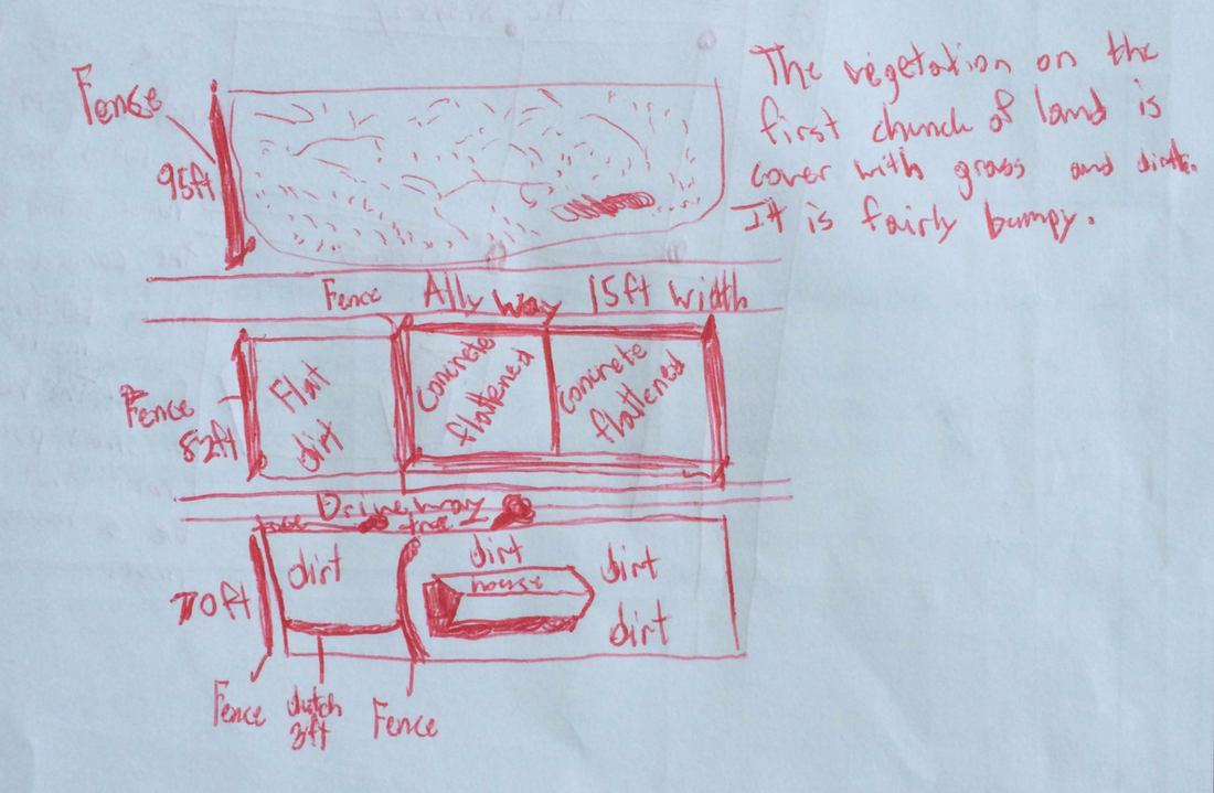
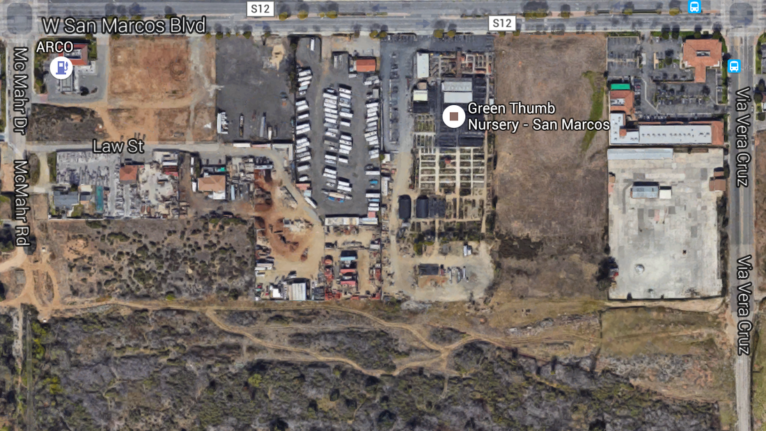
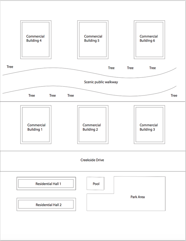
For many years now, San Marcos County has been developing a renovation project involving the Creekside District. This renovation project is intended to modernize San Marcos Boulevard, create homes, and maintain the creek from flooding. We decided to as a class, take the creek development project and replicate it on a lower scale. This project was the last project of the year and it also has been the longest project that we had this year. With all the information regarding the development being posted online, we were able to implement the requirements and intentions of the city into our project. Each group in our class received a piece of land that they had to develop however they wanted as long as it meets the requirements of the city. We had the opportunity to visit our parcel of land and apply trigonometric concepts to it to scale and measure it as a whole as well as and landmarks that it possessed within.
For many years now, San Marcos County has been developing a renovation project involving the Creekside District. This renovation project is intended to modernize San Marcos Boulevard, create homes, and maintain the creek from flooding. We decided to as a class, take the creek development project and replicate it on a lower scale. This project was the last project of the year and it also has been the longest project that we had this year. With all the information regarding the development being posted online, we were able to implement the requirements and intentions of the city into our project. Each group in our class received a piece of land that they had to develop however they wanted as long as it meets the requirements of the city. We had the opportunity to visit our parcel of land and apply trigonometric concepts to it to scale and measure it as a whole as well as and landmarks that it possessed within.
What was the process of it?
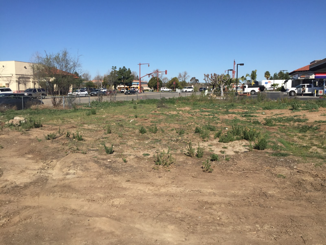
Throughout the project, I completed different tasks similar to the careers of 4 different professions. The first profession was a surveyor. My group and I were able to visit our parcel of land that we had the responsibility of renovating. When arriving at the site, we noticed that a good portion of the land was private and as a result, we weren't able to access it. However the portions of land that was inaccessible, we were able to survey using trigonometry. For example, their was a large tree sitting on a portion of the lot that was private, we used triangulation to mind the exact positioning of it. We used triangulation for many more landmarks that we needed to survey. We were eventually able to survey the entire parcel of land using trigonometry. The second category of tasks that I had completed was a Urban Planner. For this tasks, my group and I collaborated extensively to plan out what we would like to place on our parcel of land. The task involved a lot of research into the actual project that the San Marcos District had posted on their website. After our research and collaboration, we agreed upon what would be developed on our land. We then moved onto the task of engineering and architecture. We developed our building structures while incorporating all pervious aspects researched such as the measurement of the land and the land use requirements. Using additional research that we made on architecture and the rotation of the sun. We created buildings that supported the vision of San Marcos County while while using professional methods of doing such such as using Adobe Illustrator, calculating the buildings awning, and apply the golden ratio in the design of the buildings.
Throughout the project, I completed different tasks similar to the careers of 4 different professions. The first profession was a surveyor. My group and I were able to visit our parcel of land that we had the responsibility of renovating. When arriving at the site, we noticed that a good portion of the land was private and as a result, we weren't able to access it. However the portions of land that was inaccessible, we were able to survey using trigonometry. For example, their was a large tree sitting on a portion of the lot that was private, we used triangulation to mind the exact positioning of it. We used triangulation for many more landmarks that we needed to survey. We were eventually able to survey the entire parcel of land using trigonometry. The second category of tasks that I had completed was a Urban Planner. For this tasks, my group and I collaborated extensively to plan out what we would like to place on our parcel of land. The task involved a lot of research into the actual project that the San Marcos District had posted on their website. After our research and collaboration, we agreed upon what would be developed on our land. We then moved onto the task of engineering and architecture. We developed our building structures while incorporating all pervious aspects researched such as the measurement of the land and the land use requirements. Using additional research that we made on architecture and the rotation of the sun. We created buildings that supported the vision of San Marcos County while while using professional methods of doing such such as using Adobe Illustrator, calculating the buildings awning, and apply the golden ratio in the design of the buildings.
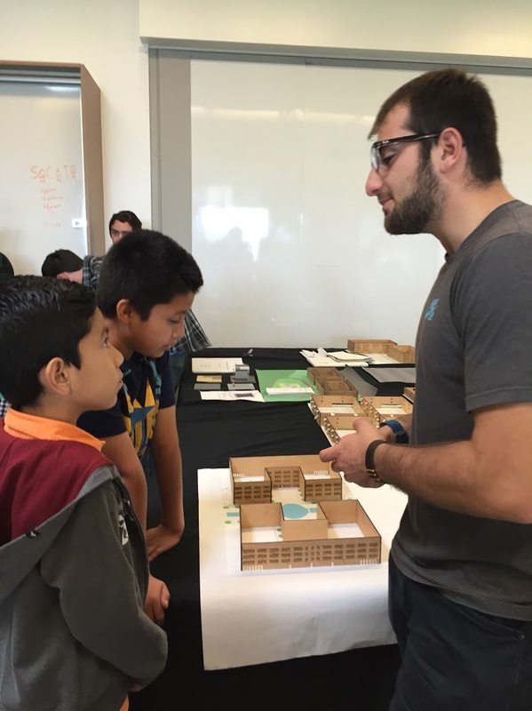
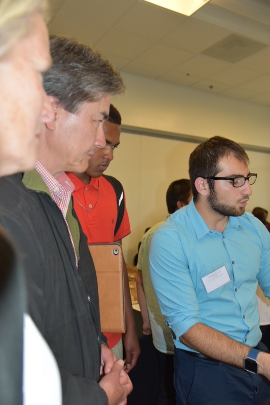
These are some images taken through the process of the project.
|
|
What was the mathematics behind all of this?
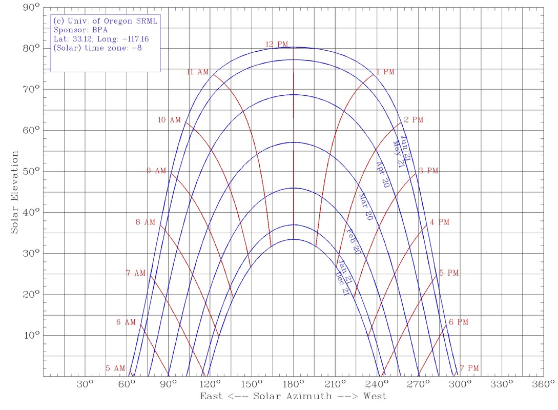
For this project, majority of the math done has been trigonometry and triangulation. Triangulation has been used mostly in the surveying that we had done in the beginning of the project. In moments in which we were not able to physically measure a landmark on our parcel of land, we used triangulation to find the exact positioning of the landmark. Triangulation is a form of measure the distance of an object without actually reaching the object itself. We created a triangle using a angle precision tool and two points of references. We measure the distance between the two points of references physically then plugged the angles given by the angle precision tool and the length between the two reference points into a trigonometric problem resulting in the length from one of the references points to the landmark chosen. We the also used trigonometry for finding the length of our awning. Using a sun path dial, we saw the path the sun traveled around our building and gathered the angles in which it shines on our buildings. We decided to as a group to cut out sunlight in the summer between 11 am to 2 pm, we spotted the angle the sun will be shining at at those times then created a right triangle in which we then used trigonometry to find the length of the necessary awning for. The last major piece of calculations that we used was the golden ratio. The golden ratio is a ration that is considered to be aesthetically pleasing no matter what. It is used largely in architecture. We used the golden ratio to find proper positioning from our windows. The ratio assisted in the design of all of our buildings.
For this project, majority of the math done has been trigonometry and triangulation. Triangulation has been used mostly in the surveying that we had done in the beginning of the project. In moments in which we were not able to physically measure a landmark on our parcel of land, we used triangulation to find the exact positioning of the landmark. Triangulation is a form of measure the distance of an object without actually reaching the object itself. We created a triangle using a angle precision tool and two points of references. We measure the distance between the two points of references physically then plugged the angles given by the angle precision tool and the length between the two reference points into a trigonometric problem resulting in the length from one of the references points to the landmark chosen. We the also used trigonometry for finding the length of our awning. Using a sun path dial, we saw the path the sun traveled around our building and gathered the angles in which it shines on our buildings. We decided to as a group to cut out sunlight in the summer between 11 am to 2 pm, we spotted the angle the sun will be shining at at those times then created a right triangle in which we then used trigonometry to find the length of the necessary awning for. The last major piece of calculations that we used was the golden ratio. The golden ratio is a ration that is considered to be aesthetically pleasing no matter what. It is used largely in architecture. We used the golden ratio to find proper positioning from our windows. The ratio assisted in the design of all of our buildings.
Reflect on this project.
This project was one of my favorite project that we had done this year. It was meant to teach my favorite math concept which is trigonometry and it was intended to also be very creative. The project went smoothly for the first quarter of progression however when it came to finding a precise measurement of our parcel, it was difficult because the boundaries were not clear. After working with my teacher regarding the issue as well as the other groups around mine that were having the same issue, we agreed upon fixed measurements. Every other aspect of the project was very intriguing and exciting to complete. It was a great opportunity to see our design in 3-D at the end as a final product.
This project was one of my favorite project that we had done this year. It was meant to teach my favorite math concept which is trigonometry and it was intended to also be very creative. The project went smoothly for the first quarter of progression however when it came to finding a precise measurement of our parcel, it was difficult because the boundaries were not clear. After working with my teacher regarding the issue as well as the other groups around mine that were having the same issue, we agreed upon fixed measurements. Every other aspect of the project was very intriguing and exciting to complete. It was a great opportunity to see our design in 3-D at the end as a final product.
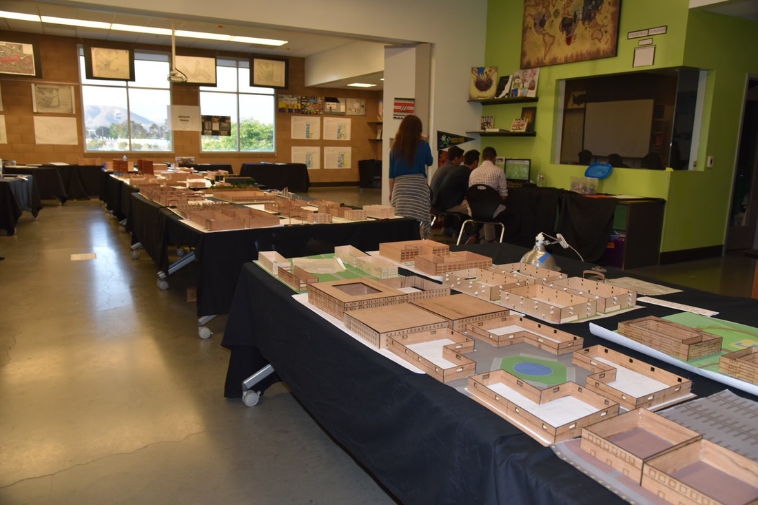
Reflect on exhibition.
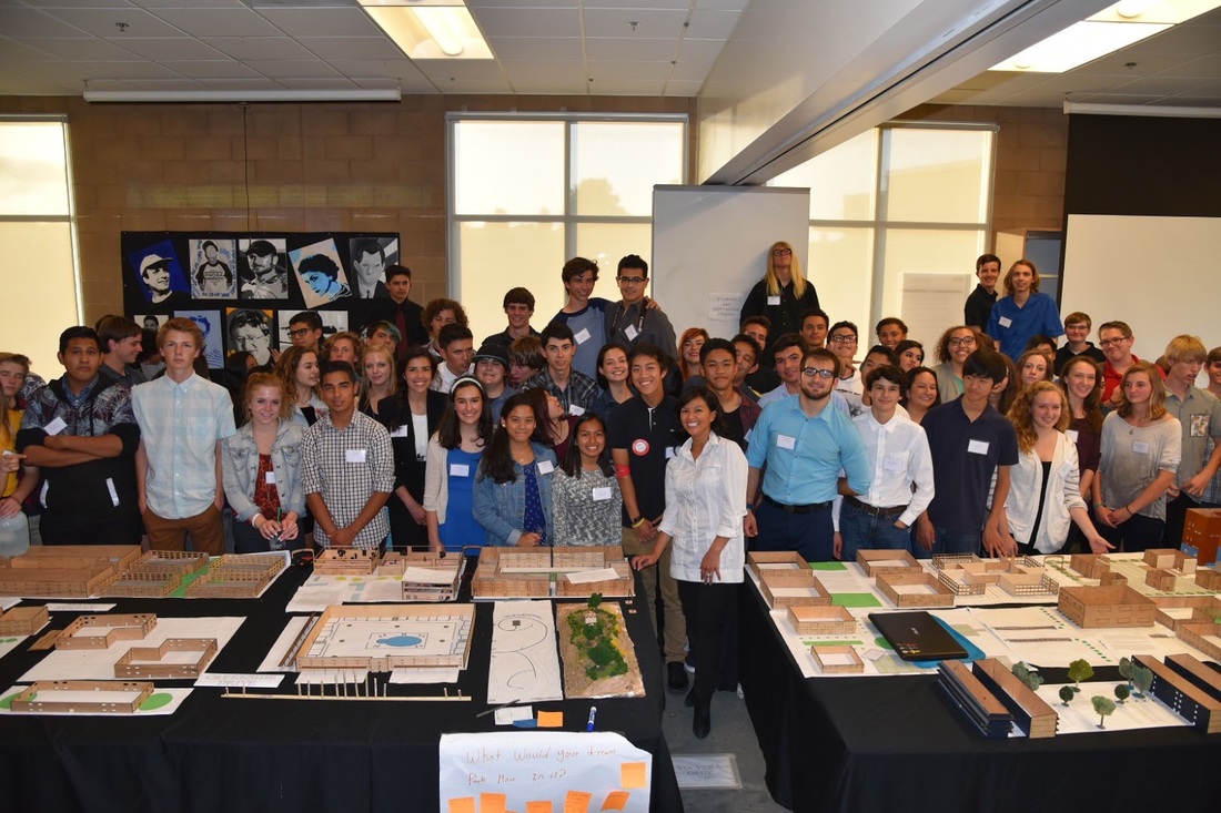
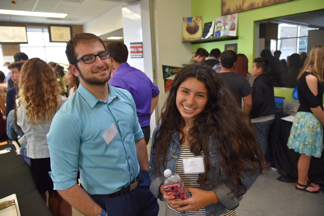
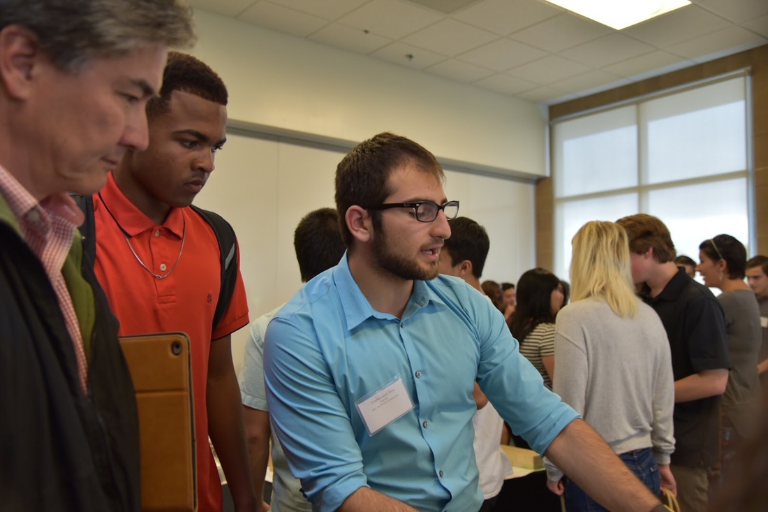
Just like most other High Tech High projects, our class put together a exhibition to present our work to the county. The setup of the room was great. It was formatted to look exactly like the creekside district with all the roads being labeled. We fortunately had many visitors making the exhibition incredibly exciting. I had the opportunity to talk to many parents and professions familiar with the work that we were doing. All our guests seemed like they were enjoying the exhibition and the models. When conversing with the guests, I was most proud of the fact that I was informed enough on the project to respond to all of their questions. Below are some pictures of exhibition.
Just like most other High Tech High projects, our class put together a exhibition to present our work to the county. The setup of the room was great. It was formatted to look exactly like the creekside district with all the roads being labeled. We fortunately had many visitors making the exhibition incredibly exciting. I had the opportunity to talk to many parents and professions familiar with the work that we were doing. All our guests seemed like they were enjoying the exhibition and the models. When conversing with the guests, I was most proud of the fact that I was informed enough on the project to respond to all of their questions. Below are some pictures of exhibition.
|
|
